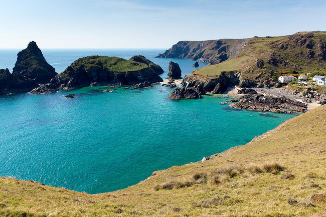
Self Guided Cycling Holiday Cornwall
This self guided cycling holiday is a great way to explore the best of Cornwall. Based in the small characterful town of Helston, this two to four night self guided cycling break covers a wide range of Cornish coastline from long sandy beaches and rocky coves to dramatic cliffs and creeks as well as the harbour towns on Portreath, Penryn and Falmouth. Explore Cornwall's inland scenery; the wide open heath of Goonhilly Down and the mining country dotted with the impressive ruins of old engine houses. Along the way take in castles, exotic sub tropical gardens and visit the most southerly point of the British mainland. £270 for 2 nights. £311 for 3 nights; £400 for 4 nights. Please use add-ons to select the duration you want. This is a great way to have amazing routes and have the logistics taken care of so you can simply - enjoy! NOTE - We’ve changed how we operate due to Covid-19 with your health and safety in mind. If you’ve got any questions on the steps we’ve taken, just drop us a messageDay 1Day 1 – Ride down the west coast through the delightful Church Cove to Mullion from where you can continue all the way down to Lizard, the most southerly point of the British mainland. This also takes you to Kynance Cove where the combination of the rare serpentine rock and the powerful sea has produced amazing beaches with cliffs, caves and islands. The next section takes you across the Goonhilly Downs where the solid rock makes a good stable platform for the satellite tracking station.Day 2Day 2 - Cycle through the Penrose Estate, an area of woodland around the Loe Pool now owned by the National Trust. Continue to Porthleven, a working fishing port and then follow the coast west to Praa Sands, a mile long sweep of sand renowned as one of Cornwall's finest family beaches that’s popular with surfers. A little further on is one of Cornwall's most famous landmarks, St. Michael's Mount, a little island community that can be reached by causeway during low tide. Approx distance: 19 or 27 milesDay 3Day 3 - Ride out to Wendron and on to the site of a reconstructed mining village. A huge beam engine dominates the site above ground while below you can explore the old tunnels and workings. The cycle ride continues through mining country with several old engine houses dotting the landscape. Continue cycling to Penryn, which was once the main port in this area before moving down the coast to Falmouth. There is still an active fishing fleet here and the docks still repair and refit some large ships although leisure is now a more important business with several exotic gardens, a maritime museum and pleasant beaches to enjoy. The impressive fortifications of Henry VIII’s Pendennis Castle still dominate the headland. Continue past more subtropical gardens to Gweek on the Helford Creek where the sheltered waters are a popular haven for leisure boats. It is also the home of the National Seal Sanctuary where they rescue injured seal pups from local beaches and also care for other abandoned sea mammals.Day 4Depart to home. Inclusions Accommodation - Comfort Bed and Breakfast Accommodation. What's Included 🍴 Food - Breakfast will be provided as part of the BnB's. 📋 Other - Luggage Transfers, Fully comprehensive tour pack with colour coded routes on local maps, Smartphone App with GPS, Emergency Telephone Assistance What you'll need 🧤 Warm Clothing ☂️ Waterproofs 🍴 Food - Meals other than breakfast 📋 Other - You'll need to organise your own transport to and from Cornwall and pay for Bike Hire or bring your own
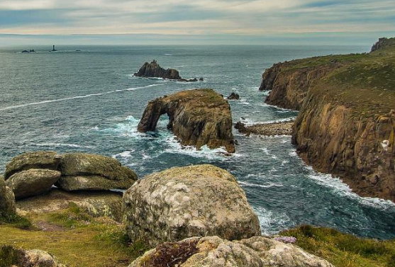
South West Coast Path Walking Holiday (South Coast) - Self Guided
The South West Coast Path is one of the UK’s managed National Trail footpaths, running 630 miles from Minehead in Somerset, round the South West tip of England all the way to Bournemouth in Dorset. This itinerary focusses on the South Cornwall Coastline, running along The English Channel from Penzance to Plymouth. This includes the popular landmark of Lizard Point and finishes just past the Devon boundary in the city of Plymouth. NOTE - We’ve changed how we operate due to Covid-19 with your health and safety in mind. If you’ve got any questions on the steps we’ve taken, just drop us a messageDay 1Arrive in Penzance and stay overnight.Day 2A: Penzance to Porthleven (13.75 miles / 22 km) Beginning your trip with easy walking, the path from Penzance to Marazion offers an easy route with limited hills. Gradually, the path becomes more rugged past Perranuthnoe and ends with a much steeper gradient to reach Porthleven. Before you begin your trip, many enjoy a trip to St Michael’s Mount which can be seen from the start of the coast path on the view to Marazion. The path begins right at the edge of the coastline, overlooking the beach all the way to Marazion. Marazion has been a settlement in one form or another since 308BC and Henry III granted it a Royal Charter in 1257. Detouring slightly into Marazion, the path returns to the shore, following Trenow Cover, around Basore Point where you can see ‘The Bears’ stone stack and on past Perran Sands. Many stop to enjoy the views from Cudden Point which juts out into the sea, but you will need to retrace your steps to the path from here. The path continues around Hoe Point before descending onto Praa Sands where you can stop for refreshments. The path from here climbs back to the cliff tops and has a number of ascents and descents on the approach to Porthleven – your stop for the night. Porthleven features an early 19th Century granite harbour and fishing remains important to the town. Stay overnight in Porthleven. Luggage will be transferred.Day 3B: Porthleven to Lizard Point (13.75 miles / 22 km) With natural coastal features including a sand bar, there is plenty of natural and historic sites of interest on today’s trip. The terrain is fairly easy to Mullion and relatively flat for the area, finishing with a number of little valleys and slopes on the way to Lizard Point. The cliffs along this stretch are particularly spectacular and there are plenty of natural stone stacks to look out for as well. Leaving Porthleven, the path quickly reaches Loe Bar, a natural sand bar blocking off a freshwater lake from the sea. The path crosses the sands here and continues straight all the way to Gunwalloe – a historic fishing cove where you can still see evidence of the trade. Just beyond on the path is Gunwalloe Church Cove where you will find the church of St Winwalow – originally dating back to the 13th century, much of the building was rebuilt in the 15th century, but you can still pop inside and see how the granite pillars lean. Following the cliffline further, you will reach the very narrow Poldhu Cove where you can stop for refreshments at the café, or you can continue to the nearby Marconi Monument. The path continues past Mullion Cliff and Mullion Cove, continuing to hug the cliffs all the way to Lizard Point – your stop for the night. Here you will climb 85 steps for a view of the lighthouse, and you can also look out for the multi-banded rock that the area is famous for. Stay overnight at Lizard Point. Luggage will be transferred.Day 4C: Lizard Point to Porthallow (15.25 miles / 24.5 km) The route begins with a few short ascents and descents before levelling out and heading somewhat inland away from the coastline. Leaving Lizard Point behind, the path hugs the cliffs and passes a number of communication landmarks including The Lizard Wireless Station, the Lloyds Signal Station and the National Coastwatch Station at Bass Point. Watch out for the curious little houses of Church Cove as well as the natural landmarks of ‘The Chair’, the ‘Devil’s Frying Pan’ and ‘Carn Barrow’. Passing through Cadgwith, you can stop here to enjoy the thatched houses and small fishing boats before picking up the path and meandering all the way to the very pretty village of Coverack. Walking from here to Lowland Point, the path turns inland, passing through St Keverne before arriving at Porthallow. Porthallow is the official halfway point of the whole South West Coastpath, although not of this itinerary. Stay overnight in Porthallow. Luggage will be transferred. Day 5D: Porthallow to Falmouth (16 miles / 26 km) It is worth checking the local tide tables for today’s trip as a number of areas can only be forded if the tide is out, otherwise there are a couple of detours or short ferry trips required. The terrain has a few small ascents and descents but is otherwise considered easy and is often very scenic. Leaving Porthallow via the grey pebble beach, the path climbs 40 steps to reach the top of the cliffs. Crossing a number of fields, the route continues around Nare Point and all the way to Gillan Harbour. As long as the tide is out, there is a very short walk across the Harbour, otherwise you will need to detour for about an hour around the creek before returning to the path. Tracking around the promontory at Dennis Head, the path passes through the tiny village of St Anthony-in-Menage at the site of a Celtic Church before tracking the coastline to Helford. There are a number of amenities at Helford where you can wait for the ferry (payable locally) to take you across the Helford River to Helford Passage. The route continues along the coastline, passing through a number of wooded areas and continuing past Trebah Gardens (worth a stop if you have time) all the way to Falmouth. The beautiful Gyllyngvase Beach offers white sands at Falmouth and the path continues around Pendennis Point to Falmouth proper. There is plenty going on in Falmouth and you can also visit Pendennis Castle and see its counterpart at St Mawes, opposite. Stay overnight in Falmouth. Luggage will be transferred. Day 6E: Falmouth to Portloe (13.75 miles / 22 km) Beginning the day with two ferry journeys (payable locally), the path starts out relatively easy but becomes progressively more challenging as the day goes on. It is important to check the ferry times as you will first need to catch a ferry from Falmouth to St Mawes and then the linking ferry from St Mawes to Place. The walking doesn’t start until you are at Place, where the route heads inland initially before returning to the coast. The first landmark is the bunker at St Anthony’s Head (where you will also find toilets) before the route gives way to mostly local cliff landscape for several miles. The route ends at Portloe, having enjoyed all the local scenery and breath taking views. Stay overnight in Portloe. Luggage will be transferred. Day 7F: Portloe to Mevagissey (12 miles / 19.5 km) Today’s route has some rugged stages, interspersed with some easier flatter stretches and a short walk along the road. Leaving Portloe behind, the path is initially rugged, crossing Hartriza Point and across a footbridge followed by a 70-step flight. The path undulates gently before reaching more steps at Caragloose Point and then a short stint inland through a wooded area. You will then reach the tiny villages of West Portholland and East Portholland and can opt to stick to the coast path between the two, or walk along the sea wall that connects them. The coast path enters woodland beyond the two Portholland villages before running alongside Caerhays Castle and Porthluney Cove; the Castle is 200 years old and is open for visits of the Castle and Gardens from February to July, while the beach has a small café and toilets. From here, the next stretch of coast path features several quick ascents and descents, following the coastline around the promontory at Dodman Point and continuing beyond. The village of Gorran Haven is the next opportunity for refreshments and from here the path hugs the coastline around Chapel Point before reaching Mevagissey – your stop for the night. Mevagissey was first recorded as a settlement in 1313 and has been a harbour since 1745. Stay overnight in Mevagissey. Luggage will be transferred. Day 8G: Mevagissey to Polmear (11.75 miles / 19 km) Much of the day is filled with ascents and descents today, some of which are steep, but the route becomes easier after Charlestown. The first part of the walk closely resembles a rollercoaster, numerous are the ascents and descents although only a few are steep. Looking inland, many mistake the view for snow-capped peaks in the distance, but in fact these are the spoil heaps from the china clay works around St Austell. The route heads inland briefly at the village of Pentewan where there is also a beautiful beach, before returning to the coastline. The path skirts Black Head where there is a small fort and also a big block of granite in memory of the Cornish Poet AL Rowse. The next major landmark, following the cliff path along the coastline, is the village of Charlestown, just outside St Austell. Charlestown traded extensively in china clay and there’s an interesting Shipwreck and Heritage Centre here as well. If you aren’t feeling too tired, many also divert inland to St Austell for a little while; St Austell is one of the biggest towns in Cornwall and was an important mining town and porcelain producer. There is also a fantastic brewery. Continuing the coast path, you have the option to cross the sands or follow the cliff path at Carlyon Bay and again at Par Sands. Just beyond Par Sands is Polmear, your stop for the night. Stay overnight in Polmear. Luggage will be transferred. Day 9H: Polmear to Polperro (13 miles / 21 km) One of the more tiring stretches of the itinerary, the route starts off fairly easy before becoming steeper and more tiring towards the end of the day. The route is typified by headlands and coves one after another. Following the cliff path out of Polmear, look out for the hidden cove at Polkerris which you will quickly reach. Today, you will walk around Gribbin Head, which has been prominent in your views for the last couple of days and which is marked by a red and white daymark that was erected in 1832. Continuing around the far side of the headland, the route brings you to Southground Point and on to Readymoney where the tiny beach is overlooked by the 16th century Catherine’s Castle. Entering the town of Fowey, you need to catch the regular ferry (payable locally) across the estuary to Polruan (please note in bad weather, the ferry departs from Town Quay further towards the centre of Fowey). From here, the path gradually gains height to overlook Lantic Bay and around Pencarrow Head. Follow the cliff line through West Coombe and then East Coombe to be rewarded with a stunning view of Polperro – your stop for the night. Polperro has great character and a lovely atmosphere and still maintains a small fishing fleet. While you are here, visit the Polperro Heritage Museum of Smuggling and Fishing for an insight into the town’s history. There is also a model village to enjoy. Stay overnight in Polperro. Luggage will be transferred. Day 10I: Polperro to Portwinkle (13 miles / 21 km) Most of the day’s walk is easy to moderate with a few short challenging bits, but plenty of easy interludes. The path is easy out of Polperro all the way to Talland Bay and on to Hore Stone with a stunning view of St George’s Island from here. Following the path past Portnadler Bay and Hannafore Point, you will reach the town of Looe and see the distinctive ‘Banjo Pier’ with its circular tip. The town is divided in half (West and East) and you can walk through the town to the small footbridge or opt for the short ferry ride which saves about half a mile. At Looe, the Old Guildhall Gaol and Museum and there are also some boat trips which run to St George’s Island when available. Leaving Looe behind, get back on the coast path heading towards Seaton and past the National Trust managed of Bodigga Cliff. There is a small monkey sanctuary off to the right which also has a café, or you can continue on the path running slightly inland all the way to Seaton. From Seaton, it is a short walk to the village of Downderry; some of the route here is along the road so walk with care, but if the tide is out, you can instead walk along the sea wall and beach. Finally, the day ends with a short walk to Portwinkle - your stop for the night. Stay overnight in Portwinkle. Luggage will be transferred. Day 11J: Portwinkle to Plymouth (12.75 miles / 20.5 km) Much of the day’s walking is through woodland today and is mostly classed as easy. It is also the last stretch of the coast path in Cornwall, moving into the county of Devon to end the day in Plymouth. Not long after Portwinkle there are two options for the route; the first sticks to the coastline all the way to Tregantle Fort but is part of a military training zone and cannot be used on active firing days. The second tracks inland skirting the military danger zone and on around the Fort. Continuing on past Sharrow Point there is a short stretch near to Tregonhawke which runs along the road after the footpath was closed a few years ago. It quickly returns to footpath and on to Captain Blake’s Point before reaching Rame Head. The path doesn’t go all the way out onto the headland here, but if you want to you can head out onto the headland to visit St Michael’s Chapel which was built in 1397. Leaving one headland to walk immediately around the next at Penlee Point, it is not long until you reach the villages of Cawsand and Kingsand, both of which have refreshments and amenities. From here, the path follows the cliff line through Mount Edgcumbe Country Park and past Fort Picklecombe to Devil’s Point in the Estuary. Here, you will need to catch the ferry across (payable locally) to Plymouth – your stop for the night. Plymouth is the biggest City anywhere on the South West Coast Path and there is plenty to see and do. Stay overnight in Plymouth. Luggage will be transferred. Inclusions Accommodation - Luxury Accommodation at the stated category. What's Included 🍴 Food - Breakfast will be provided. 📋 Other - Luggage Transfers, Full Tour Pack, Smartphone App with GPS routes, 24-hr emergency helpline. What you'll need 🍴 Food - Lunch, Dinner 🥤 Drink - Drinks 📋 Other - Entrance to attractions, Buses and/or Ferries unless otherwise stated, Tourist Taxes where applicable
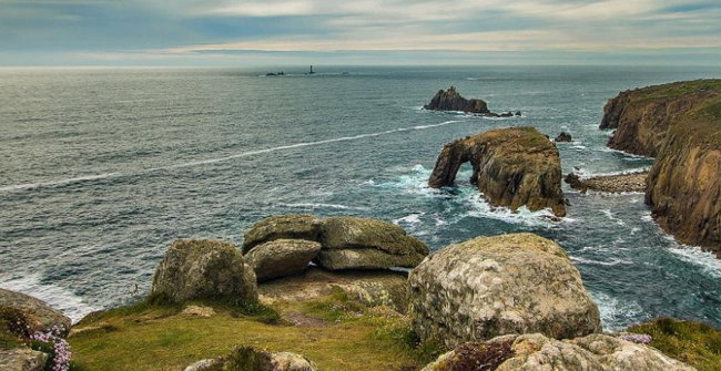
Self Guided Walking Holiday Exploring Cornwall and The Lizard Peninsula
This Cornwall Walking Holiday, explores the Lizard Peninsula which is the southern-most tip of England and offers a beautiful coastline combined with a relatively mild climate. The tour includes a great variety of coast and heathland, taking clients through picturesque fishing villages, as well as the tree-lined creeks that inspired the novels of Daphne du Maurier. An exciting Cornish Walking Holiday which allows you to explore picturesque fishing harbours while following the spectacular Lizard Peninsula coastal path as well as allowing you to visit the tree-lined creeks that inspired the novels of Daphne du Maurier. Uses the longest National Walking Trail in the UK, at 630 miles long this follows a superb coastline with heritage, wildlife, geology and scenery along the way which are truly inspirational and every day walking it brings stunning new experiences. There are lots of attractions and places to explore during your short Cornwall walking tour, including: Goonhilly Earth Station Helford Helston Lizard Village & Lighthouse Mullion Penrose Estate Porthallow Vineyard St Keverne Plenty of stops for Cornish pasties and cream teas! NOTE - We’ve changed how we operate due to Covid-19 with your health and safety in mind. If you’ve got any questions on the steps we’ve taken, just drop us a messageDay 1A: Circuit from Helston via Loe Pool (Full route: 8.5 miles / 13.7km | Short Route: 6.75 miles / 11 km) Enjoy a gentle start to the day with an easy circular walk around the Loe Pool, Cornwall’s largest natural area of fresh water. This route then continues into the woodland of the Penrose Estate and on to the little fishing harbour of Porthleven before returning to Helston. Overnight in Helston. No luggage transfer required. Day 2B: Linear route from Helston to St Keverne, via Manaccan (Full route: 9.5 miles / 15km | Short Route: 5.5 miles / 9 km) Today begins with a short taxi transfer (included in the price) across The Lizard to Manaccan. From here you can explore the mysterious calm waters and wooded banks of Frenchmans Creek which inspired many novels from Daphne du Maurier. You will then follow the coast path south along beautiful rugged cliffs and sandy coves through the little harbour at Porthallow to the village of St. Keverne. Overnight in St Keverne. Luggage will be transferred. Day 3C: Circuit from St Keverne via Coverack (Full route: 8.75 miles / 14 km | Short Route: 6.25 miles / 10 km) This circular walk takes you south across the rich pastures to the coast of Coverack where pretty cottages cluster around the harbour. You then return along a section of the coast path that varies from rocky cliffs to flat and pebble covered. You will also pass the notorious offshore rocks on Lowland Point that has wrecked an estimated 150 ships. Overnight in St Keverne. No luggage transfer required. Day 4D: Linear route from St Keverne to Mullion, via Arrowan (Full route: 8 miles / 13 km | No Short Route) Today begins with a short taxi transfer (included in the price) to Arrowan. You then follow the South West Coast Path passing Kennack Sands, The National Trust “Old Serpentine Works”, Cadgewith and Church Coves before arriving at Housel Beach near Lizard Point. It then a short bus ride from Lizard to Mullion, the largest village on the Peninsula with shops, inns, restaurants and an art gallery to enjoy. Overnight in Mullion. Luggage will be transferred. Day 5E: Circuit from Mullion via Kynance Cove (Full route: 8.5 miles / 13.7 km | Short Route: 6 miles / 9.7 km) Take the bus back to Lizard Village, the most southerly point of the British mainland. It has been a popular holiday destination since Victorian times and the coast around it still attracts modern travellers. From the famous lighthouse, follow one of the most dramatic and beautiful sections of the coast path back to Mullion, past the sheltered beaches and remarkable rock formations of Kynance Cove. Please note, the bus ticket costs £15 and is payable locally. Overnight in Mullion. No luggage transfer required. Day 6Depart for home. Inclusions Accommodation - Comfort Bed and Breakfast Accommodation. What's Included 🍴 Food - Breakfast will be provided. 📋 Other - Luggage Transfers, Fully comprehensive tour pack with colour coded routes on local maps, Emergency Telephone Assistance, Smartphone App with GPS What you'll need 📋 Other - Transport to and from Cornwall
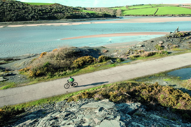
Self Guided Cycling Holiday Shell Seekers Film Tour, Including the Camel Trail
This self-guided cycling holiday based in Cornwall will allow you to explore the locations from the popular Rosamunde Pilcher novel, The Shell Seekers as well as some of the filming locations of the popular German Television adaptation. It will take you to the area where the author grew up as well as the stunning Lamorna Cove. This tiny fishing village also starred in what’s considered Rosamunde Pilcher’s most famous work. You will also have the opportunity to explore various spots as detailed in Rosamunde Pilcher’s classic novels including St Michael's Mount and much more! You'll start off on the stunning Camel Trail taking in the major sights: Bodmin Train Station (The Shell Seekers Filming Location) Lamorna Cove (The Shell Seekers Filming Location) St Michael’s Mount (The Shell Seekers Filming Location) Land’s End (The Shell Seekers Filming Location) NOTE - We’ve changed how we operate due to Covid-19 with your health and safety in mind. If you’ve got any questions on the steps we’ve taken, just drop us a messageDay 1Arrive in Bodmin. Stay overnight.Day 2A: Linear Route from Bodmin to St Austell (Full route: 23 miles / 37 km | No Short Route) Start your Shell Seeking journey by using the Camel Trail and follow the cycle route from Bodmin to St Austell. During today’s ride you will experience a variety of stunning scenery and interesting locations including Bodmin, Lanhydrock House and the stunning Eden Project. Stay overnight in St Austell. Luggage will be transferred. Day 3B: Linear route from St Austell to Truro (Full route: 26 miles / 41 km | No Short Route) Apart from a few steep hills, you will cycle mainly through the beautiful rolling Cornish countryside. Cycle out of St Austell on the Avon cycleway, then onto a quiet road, before descending into the pretty coastal village of Pentewan. Here head off along the cycle track through woods before climbing up to the famous Lost Gardens of Heligan where you can explore these amazing gardens and sculptures that are among them. You will then head through Lamorran and Tresillian and finally reach the town of Truro where you will stay the night. Stay overnight in Truro. Luggage will be transferred. Day 4C: Linear route from Truro to Helston (Full route: 30.5 miles / 49 km | Short Route: 23 miles / 37 km) There is a short climb out of Truro and a few steep hills to cycle in Falmouth, Constantine and Gweek. In between is rolling country with regular steady hills. Pass the old tin mine at Wheal Jane to Penryn, once the main port in this area, its heritage is displayed in some fine architecture from Tudor to Georgian and in a small museum. Continue down the coast to Falmouth, a busy pleasant town where the atmosphere is flavoured by the salt sea air. Here you can visit several exotic gardens a Maritime Museum and some pleasant beaches. Impressive fortifications of Henry VIII’s Pendennis Castle still dominate the headland. Continue past more subtropical gardens to Gweek on the Helford Creek, the home of the National Seal Sanctuary where they rescue injured seal pups from local beaches and also care for other abandoned sea mammals. Stay overnight in Helston. Luggage will be transferred. Day 5D: Circular route from Helston (Full route: 35 miles / 56 km | Short Route: 24 miles / 38 km) Explore the west coast through the delightful Church Cove to Mullion from where you can continue all the way down to Lizard, the most southerly point of the British mainland. This also takes you to Kynance Cove where the combination of the rare serpentine rock and the powerful sea has produced amazing beaches with cliffs, caves and islands. Next cross Goonhilly Downs where the underlying serpentine rock gives the area most of its special characteristics. The soil it produces is the ideal habitat for the Cornish Heath that is almost unique to this area. It supports rare wildlife including the hen harrier and short-eared owl and is also the home of a satellite tracking station. Stay overnight in Helston. No luggage transfer required. Day 6E: Linear route from Helston to Penzance (Full route: 18 miles / 29 km | No Short Route) Leaving Helston, continue to Porthleven which for many years the local centre for boat building and is still a working fishing port. Then follow the coast west to Praa Sands, this mile-long sweep of sand is renowned as one of Cornwall’s finest family beaches and also popular with surfers. Further on is one of Cornwall's most famous landmarks and popular filming location in the German TV series The Shell Seekers, St. Michael’s Mount, a little island community that can be reached by causeway at low tide. Today's ride will end in Penzance where another mini-series, Coming Home was also filmed. Stay overnight in Penzance. Luggage will be transferred. Day 7F: Circular route from Penzance (Full Route: 28 miles / 45 km | Short Route: 18 miles / 29 km) Newlyn is England’s busiest fishing port. The scenery inspired the Newlyn School of artists and their legacy can be seen in museums and galleries around the town. Continue through narrow streets past little Mousehole harbour and over to the pretty, sheltered Lamorna Cove, a lovely spot for a swim. Lamorna Cove is also a recognisable spot in Rosamunde Pilcher’s The Shell Seekers German TV series. Pass the Merry Maidens, a Bronze Age stone circle that stands amidst a remarkable concentration of ancient Celtic standing stones to Lands End. Lands End is a fantastic destination and it can be seen in the German TV adaptation of the novel. Stay overnight in Penzance. No luggage transfer required. Inclusions Accommodation - Luxury Hotel Accommodation What's Included 🚆 Transportation - Bike Hire 🍴 Food - Breakfast is included 📋 Other - Luggage Transfers, Fully comprehensive tour pack with colour coded routes on local maps, Smartphone App with GPS, Emergency Telephone Assistance What you'll need 🍴 Food - Meals - breakfast is included 📋 Other - Visitor Attraction Entrance Fees, Insurances, Transport to and from Cornwall
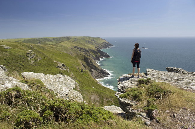
South West Coast Path Walking Holiday (North Coast) - Self Guided
The South West Coast Path is one of the UK’s managed National Trail footpaths, running 630 miles from Minehead in Somerset, round the South West tip of England all the way to Bournemouth in Dorset. This itinerary focuses on the North Cornwall Coastline on the Atlantic / Irish sea side, starting in Bude and continuing round the tip of Land’s End to finish in Penzance. This section of the route really hugs the coastline, sticking along the cliff edge for the majority of the route. This tour has many highlights including: Beautiful beaches in Bude The stunning coastal village of Boscastle Port Isaac; the filming location of Doc Martin The surfing town of Newquay The gorgeous views in St Ives NOTE - We’ve changed how we operate due to Covid-19 with your health and safety in mind. If you’ve got any questions on the steps we’ve taken, just drop us a messageDay 1Arrive in Bude and stay overnight.Day 2A: Bude to Boscastle (17 miles / 27 km) Leaving the beautiful beaches of Bude behind, the first part of today’s walk is classified as easy, all the way to Widemouth Bay. The path starts the day off grassy before giving way to a track lined with gorse bushes, hugging the cliff past Compass Point Tower, Phillip’s Point, Higher Longbeak and Lower Longbeak, before reaching Widemouth Sands. Here, you will descend into the beautiful bay to stick on the paths, before rising back onto the grassy slope at Black Rock. Continuing between a mix of grassland, gorse shrubbery and small woodland, today’s route is famous for its views, as well as the sites of geological interest like Crackington Haven where the rock strata are clearly visible. The path from here is fairly straight forward although there are one or two stepped climbs, before Penally Point gives you the first view of Boscastle Harbour. Boscastle is your stop for the night. Stay overnight in Boscastle. Luggage will be transferred. Day 3B: Boscastle to Port Isaac (14 miles / 22 km) Leaving Boscastle Harbour via the Bridge, the scenery here is stunning and many opt to detour to the old, whitewashed customs building that affords exceptional harbour views. The path follows the cliff line although it cuts across one or two of the particularly rocky headlands, and you’ll be able to spot numerous rock stacks formed by the sea. At Tintagel Head, visit Tintagel Castle – a crumbling ancient monastery – and Castle Cove where there are refreshments and a visitor centre before continuing. Look out for Gull Rock out to sea and Glebe Cliff which are both marked before following the path across the countryside to end the day in Port Isaac. You will find Port Gaverne and Port Isaac side by side; Port Gaverne was a thriving port to ship slate meanwhile Port Isaac was a fishing village. Pop along to the Port Isaac harbour to inspect the day’s catch. Stay overnight in Port Isaac. Luggage will be transferred. Day 4C: Port Isaac to Padstow (12 miles / 19 km) Immediately outside of Port Isaac, the route is dominated by a series of small valleys meaning ascents and descents, but they are not too strenuous, and the route flattens out later. Your first village of the day is Port Quin (although please note it is very small and has only a water tap available) before the coast path returns to the rugged local landscape around Rumps Point and Pentire Point. From here, it is a short distance to Hayle Bay where you will also find the town of Polzeath – a great place to stop for refreshments. Leaving Polzeath via the ‘Doom Bar’ beach formation and Daymer Bay you will reach the village of Rock. Opposite on the estuary is Padstow – your destination for the day. A ferry will take you across from Rock to Padstow although intrepid walkers may opt to take the lengthy walk inland via Weymouth if they prefer. Padstow is a historic fishing village, although this is no longer a major local industry, and you can hop onto a boat trip here. Stay overnight in Padstow. Luggage will be transferred. Day 5D: Padstow to Porthcothan (14 miles / 22 km) Leaving Padstow behind, today’s route is relatively easy, leaving plenty of time for local exploration. Taking in two large headlands – Stepper Point and Trevose Head – the route is also dotted with beaches and bays. You can opt to start the day crossing the beach but the coast path itself starts to run inland across fields and across a wetland area. Particular highlights are the views at Pepper Hole, Butter Hole, Gunver Head and Round Hole and many opt to pause for a rest at Trevone Bay where there are also refreshments available locally. Harlyn Bay can prove slightly tricky in that it is somewhat impassable at high tide, but a short wait at the local inn will soon have you walking again (there is no inland alternative at this point unless you opt to use rural roads). Crossing the lighthouse access road at Trevose Head, the path continues to follow the coast, skirting the many small bays to end in Porthcothan, your stop for the night. Stay overnight in Porthcothan. Luggage will be transferred.Day 6E: Porthcothan to Newquay (11.5 miles / 18 km) The only steep climbs on today’s route are short and over quickly, making this an easy part of the route. The route is considered very scenic with Bedruthan Steps a popular highlight thanks to the beach littered with rock stacks. Today’s route often allows you to select between sandy stretches and the traditional coast path above to shortcut past them. Watergate bay is a great place to stop for refreshments. At the end of Watergate Bay, the path appears to continue to Trevelgue Head, but this is an Island and a footbridge allows you to reach the island as an optional extra. From here, depending on the tides you can either continue via the beach, or return to the coast path past Tolcarne Beach and into Newquay. Originally named ‘Towanblistra’ a ‘new quay’ was built in the 16th century, allowing the town to prosper as a port so that it later became known as Newquay. This is the largest town on this part of the South West Coast Path, with the widest range of facilities and your overnight stop for today. Stay overnight in Newquay. Luggage will be transferred. Day 7F: Newquay to Perranporth (11.5 miles / 18 km) Leaving Newquay there are a couple of easy headlands on the outskirts of the town, before walkers reach The Gannel. There are three ways to cross The Gannel – one official, two unofficial – by means of a low tide footbridge, an unofficial seasonal ferry (for high tide) and an unofficial walk across the sands at low tide. If you time the tides wrong and there is no ferry running them there is an inland route, but it adds quite a distance (2.5 miles / 4km) so many opt just to wait or to take a taxi to Crantock. Once past The Gannel, walkers reach Crantock and Crantock Beach and on round the double headland of Pentire Point West and Kelsey Head before reaching Holywell Village. Just beyond Holywell is Penhale Point – stick to the path to avoid old mine shafts – and you will also see signs for the Penhale Army training area. After a turn at Ligger Point, the route descends onto the sand to cross Perran Beach to reach Perranporth where you will stay overnight. Stay overnight in Perranporth. Luggage will be transferred. Day 8G: Perranporth to Portreath (12 miles / 19.5 km) Today’s route is dominated by evidence of the once bustling mining industry, with a landscape that is often described as moody or bleak. Old mine shafts, engine houses and chimneys are dotted across the landscape, but it is perfectly safe to traverse via the marked path. In places, much of the walk is quite tough with steep climbs, but the views are worth it. Stop at the mining museum at Blue Hills Tin Streams; the mine itself closed in 1897, but it was developed as an attraction in 1975 and you can see how tin ore is crushed, washed and smelted. Continue around St Agnes Head. The final descent runs down Lighthouse Hill overlooking Porthreath. Stay overnight in Portreath. Luggage will be transferred. Day 9H: Porthreath to St Ives (18 miles / 29 km) Leaving Portreath, the trail initially has some steep ascents and descents, but quickly levels out and runs easily along the cliffs and around the headlands to Godevry. There are few villages to visit on today’s route, but there are a few strategically placed cafes for refreshments. The coastline on today’s walk features plenty of interesting features including rock stacks and islands as walkers continue all the way to Godevry. Here you can spot the lighthouse out on Godevry Island, and this also marks the start of a long bay; walkers can select between a walk across the dunes, or down on the beach if the tide is out. At Hayle, there is a detour into the village around the River Hayle Estuary, before the landscape returns to the Blue Flag Awarded beach of Carbis Bay and finally into St Ives. St Ives was formed at a natural harbour which was protected by St Ives Head. It was originally a fishing port, but now has a reputation for arts and crafts. It can be particularly busy during the peak summer season, so pre-booking of hotels and restaurants is recommended. Stay overnight in St Ives. Luggage will be transferred. Day 10I: St Ives to Pendeen Watch (13.5 miles / 21.5 km) For this stretch, it is highly recommended to start early and enjoy a leisurely pace rather than an arduous trek, taking in some of the most spectacular scenery on the whole path. It is also recommended to take good provisions as many of the places for refreshment require a detour. The trail for the whole day sticks to the cliff edge and there are limited detours inland. The path is very wiggly, meandering around plenty of points and headlands. Look out for the granite Tors at Boswednack Cliff, as well as the ancient settlement site at Bosigran Castle and the lighthouse at Pendeen Watch. Pendeen Watch retains many original features of the former tin-mining industry including old chimneys, engine houses and winding gear. Stay overnight in Pendeen Watch. Stay overnight in Pendeen Watch. Luggage will be transferred. Day 11J: Pendeen Watch to Porthcurno (15.5 miles / 25 km) The tin mining features of Pendeen Watch quickly gives way to classic cliff walking and the route also includes Cape Cornwall, one of the most popular views in the County. The route starts out rugged to Sennen Cove, before becoming an easy path to Land’s End. Highlights of the route include Kenidjack Castle – an Iron Age fortification, the landmark chimney at Cape Cornwall, the little fishing harbour and Old Roundhouse at Sennen Cove and of course Land’s End. Leaving Land’s End behind, the route to Porthcurno is described as fairly easy and offers some of the best cliff scenery on the whole coast path. Once in Porthcurno, your stop for the night, take advantage of some of the County’s more unusual cultural sites. The Minack Theatre sits right on the cliff edge, The Museum of Submarine Telegraphy looks at how telegraph cables were laid under the sea to connect the Empire, and then the Secret World War II communications bunker. Stay overnight in Porthcurno. Luggage will be transferred. Day 12K: Porthcurno to Penzance (11.5 miles / 18.5 km) The final stretch of the holiday features several long, easy stretches of walking, interspersed with more rugged sections of the route. Leaving Porthcurno, the path moves away from the beach and up onto the cliff, leading around the nearby points and headlands. Much of the route is grassy, although there are some sections of woodland which are particularly unusual on this part of the coastline. Highlights of the day include the lighthouse at Tater-du, flanked by St Loy’s Cove and Lamorna Cove, as well as the very gorgeous village of Mousehole and the village of Newyln. Both started life as fishing villages, but Mousehole is now known for arts and crafts while Newlyn has retained its fishing industry. From Newlyn, it is a short walk into Penzance – your final stop of the trip. Penzance was also a fishing village, ransacked by the Spanish fleet in 1595, the village survived and now the town of Penzance has built up in its place. Stay overnight in Penzance. Luggage will be transferred. Inclusions Accommodation - Comfort Accommodation at the stated category. What's Included 🍴 Food - Breakfast will be provided 📋 Other - Luggage Transfers, Full Tour Pack, Smartphone App with GPS routes, 24-hr emergency helpline What you'll need 🍴 Food - Lunch, Dinner 🥤 Drink - Drinks 📋 Other - Entrance to attractions, Buses and/or Ferries unless otherwise stated, Tourist Taxes where applicable.